
East Branch Nackawic Stream
Video
Store

Quick Facts
| Features | wilderness |
| Access | loose gravel slope |
| Route Difficulty | moderate |
| Water Body Type | stream |
| Current Type | minimal |
| Route Type | linear |
| Route Distance | 2 km return |
| Portage Distance | 15 metres |
| Estimated Time | 2 hours |
| Elevation Change | 5 metres |
| Scenery Rating | beautiful |
| Cell Reception | minimal |
| Fees | none |
Description
Note: Weather conditions can drastically vary the speed and difficulty of your trip. Please plan accordingly.
I have been trying to find a way into the Taffy Lake system for several years. This chain behind the village of Millville is made up of three lakes, separated by long wetlands. In doing my research on Google Maps I found a forestry road that I thought might get me close. The road goes over a bridge on the East Branch Nackawic Stream, that feeds into Taffy Lake. When I got there I was excited to see that the road to the bridge was well maintained.
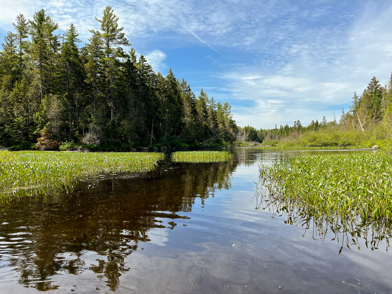
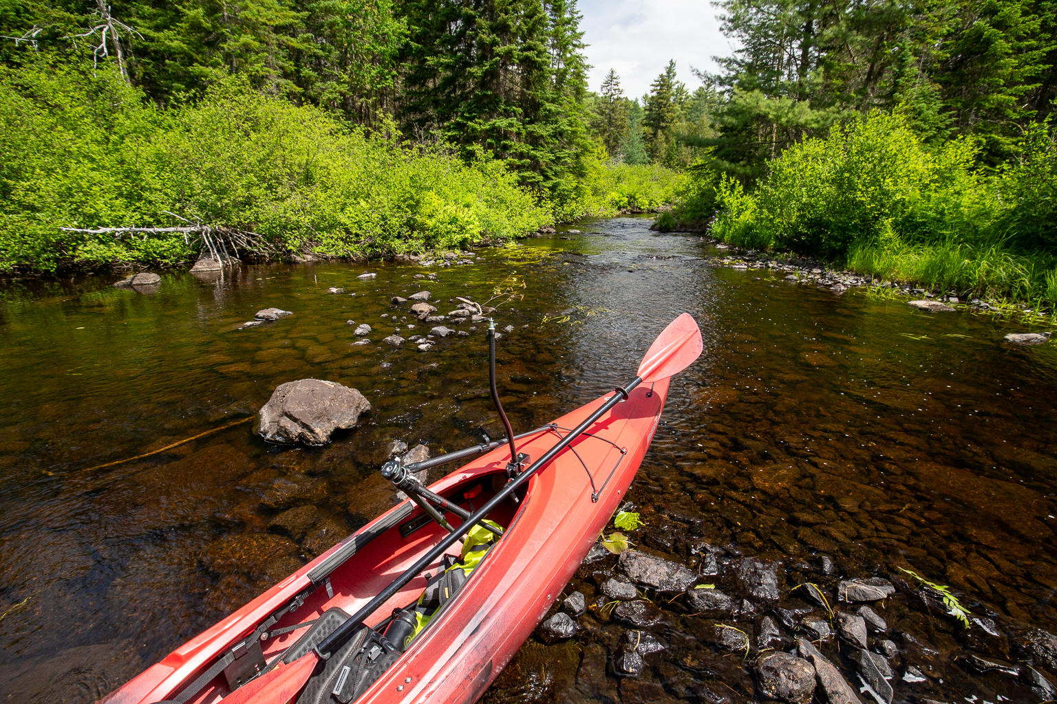
From the bridge I could see that the section below the bridge was too shallow to paddle, but it looked like it opened up into a pond in a short distance. I was careful making my way down the loose gravel slope to the edge of the stream, especially when I had the kayak on my head. I put in above the bridge but soon had to get out and walk my boat down under the bridge and through the rocky section of stream. This section dumped into a long narrow pond as I suspected. There were thick marsh grasses to the left so I turned right and headed downstream. It didn't take long before I came to a thick beaver dam blocking the stream. It looked like it had been there for a while. The stream below the dam was shallow and rocky. I decided to do some recon with my drone.
The drone confirmed that the Taffy Lake system would be a great place to explore. It also showed that the stream continued to be shallow and rocky all the way to the Lake. I was still about 500 metres from the lake. It was an option for getting into the lake system but not a great option. It was a really hot day (33°C) and I didn't have a lot of time. I decided it was best to spend my time exploring the stream above the bridge instead of trying to drag my boat down to the lake and back. I would have to come back and try it again on a cooler day, when I had more time.
I drug my boat back up under the bridge and started to explore the stream. The map showed close to 1 kilometre of wide stream but I wasn't sure what I would find after that. Something strange swam across the water in front of me. I got my camera out just in time to get a blurry picture of a snake. Not long after that I watched a large beaver swim into the bushes on one side. I was slowly paddling and looking for more wildlife when I noticed a large Great-horned owl up in one of the trees along the stream (see video). I soon came to a shallow spot where the rocky stream above dumped into this long flat part. I sat and watched the many damselflies take off and land on the surrounding grasses.
After watching the damselflies for a while I decided to get out and scout further up the stream. On the map there looked to be an opening around the turn. I walked a ways but only found more shallow, rocky stream that was grown in with alders. I decided there wasn't enough on the map to warrant me exploring further. I returned to the bridge and loaded the kayak on the car. It was 36°C out now and I worked up quite a sweat so was glad to get in the air conditioned car.
Map

Directions
Find your way to Crabbe Mountain on Route 104. Continue on Route 104 past the turn off to Crabbe Mountain. You will descend a long hill for about 2 kilometres. At the bottom of the hill you will find a gravel road crossing Route 104 (if you come to the village of Millville you have gone too far). Turn right into this gravel road. This is a main forestry haul road so use caution, especially during the weekdays.
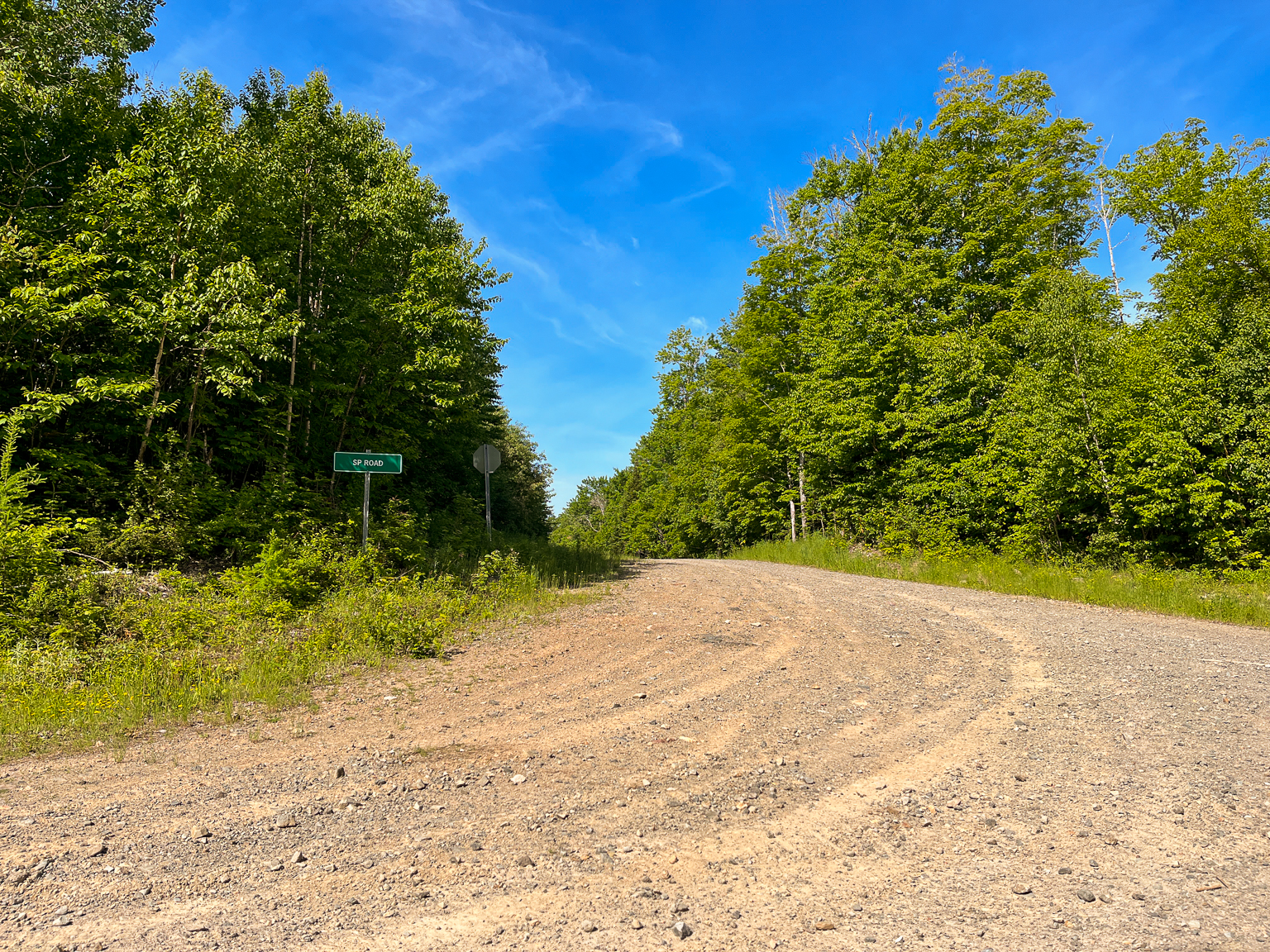
Drive on the road for 8.4 kilometres and the road will split. Take the road on the left of the split and climb a small hill. Follow this road taking several sharp turns. At 6 kilometres turn left into SP Road. Follow this road for 3 kilometres and after several turns you will come to a bridge over East Branch Nackawic Stream. I parked before the bridge on the left. There is a rough trail down to the stream on the other side of the bridge on the right.
Gallery

Other Routes nearby
Trail Last Hiked: June 24, 2023.
Page Last Updated: November 19, 2023.